 History")

Reposted from the Cliff Mass Weather Blog
If you are living west of the Cascade crest of Oregon and Washington, tomorrow will be a day you will never forget.
The latest model runs, all at very high resolution, show even more profound extremes than previously predicted. And the end of the event will be extraordinary, with temperatures falling by as much as 50F within a few hours.

Records Already Broken
Many records fell yesterday, including a new all-time high temperature at Portland (108F) and daily or monthly records falling at dozens of stations. But his is nothing compared to what will happen now.
Situation Right Now (Noon Sunday)
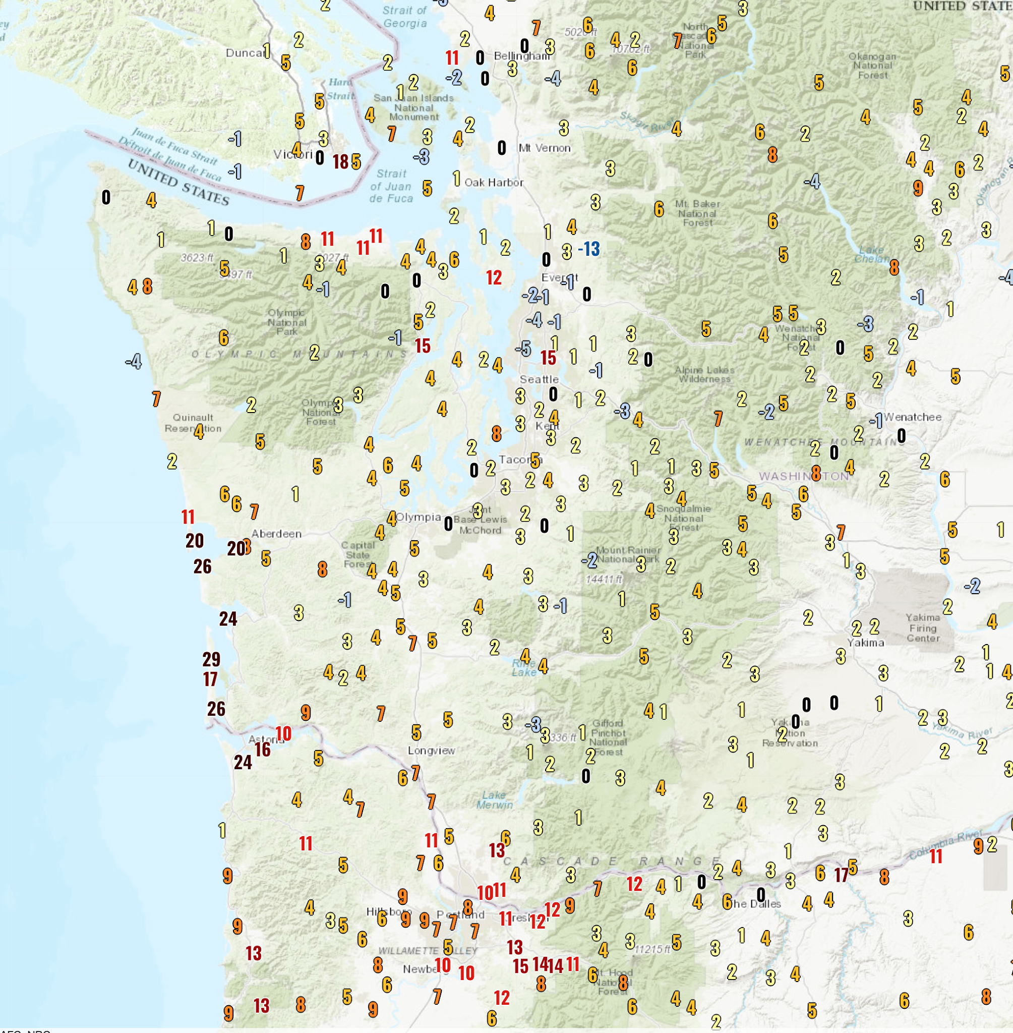
A fascinating plot (below, click on image to expand) shows you the 24-h temperature change–how we stack up temperature-wise compared to exactly one day ago.
Along the SW WA coast, some locations are 15-30F warmer, because of the switch to easterly (from east) winds–pushing away the cool, ocean air. But look at the Portland area…many locations are 10-15F warmer because of increased offshore flow, with the air warming by compression as it sinks over the western slopes of the Cascades.

The new 108F record at Portland is going to be OBLITERATED today. 115F is quite possible.
But north of Seattle temperatures were a bit cooler.
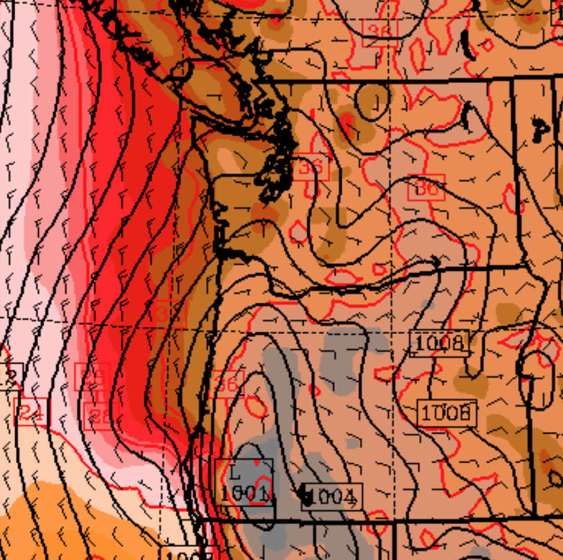
Ironically, it is connected with the warmth along the coast and around Portland! To explain, here is the forecast sea-level pressure map at 5 PM today. You can see the low-level winds and lines of constant pressure (isobars). You will also notice an area of low pressure–the thermal trough--centered in the Willamette Valley. It is the result of warm air produced by easterly flow descending the western Cascade slopes. With low pressure to the south and high pressure to the north, the thermal trough produced northerly winds over the Puget Sound, with the air cooled as it moved over cooler water to the north.

But that low pressure is going to move northward overnight and Puget Sound will be “enjoy” the torrid conditions now burning Portland.
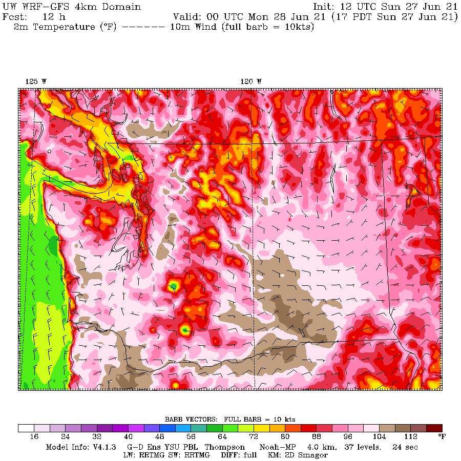
Here is the latest temperature forecast for 5 PM today. You can see the very warm conditions around Portland (dark brown is 109-112) and you will see very warm conditions along the lower western slopes of the central Washington Cascades and nearby lowlands. Near the water around Seattle near the water, it will ONLY be the upper 90s.

Tomorrow: The Day of Unimaginable Extremes
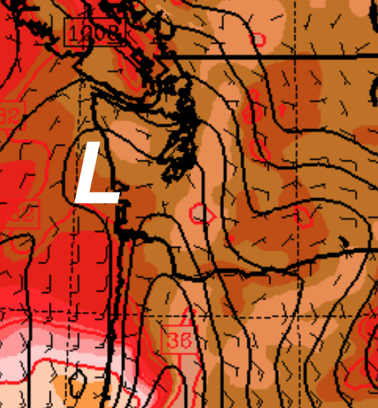
But tomorrow, it all goes horribly wrong. The thermal trough moves northward and westward, pushing the strong easterly, downslope flow northward to over the central Cascades (see map for 11 AM Monday). The sinking air will compress/warm as it sinks.

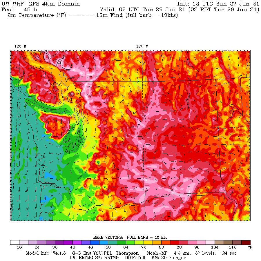
The burst of downslope, compressional heating will cause temperatures to warm beyond the experience of any living inhabitant of the region (see forecast temperatures at 5 PM Monday). Temperatures will rise above 112F on the eastside of Puget Sound and above 100F for everyone more than a few miles from the water. Portland will be similarly warm. And so will the lower elevations of the Columbia Basin. Heat apocalypse. What more can be said?

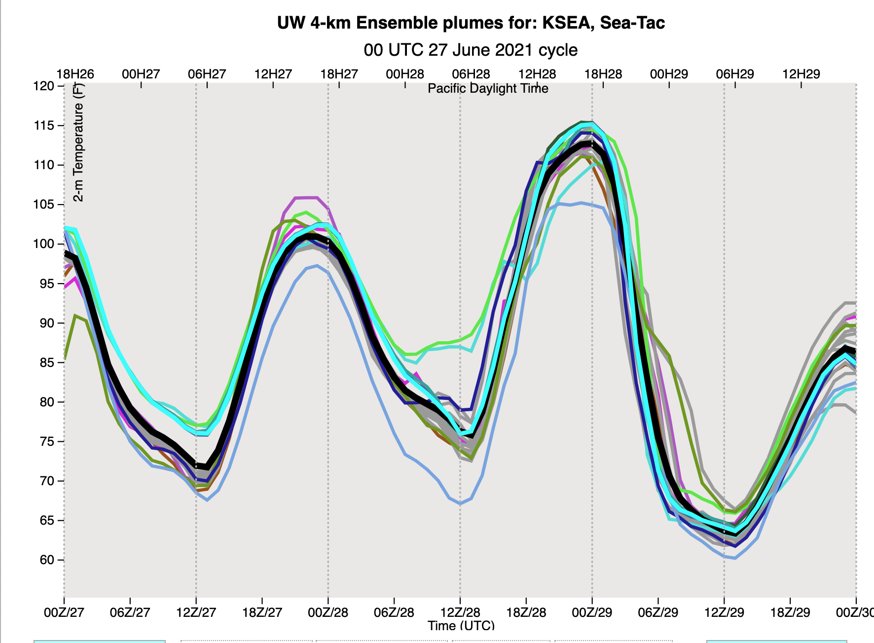
You all know that looking at one forecast is not good enough. We need to examine many (ensembles) to evaluate our confidence in the forecast. Well, here are the high-resolution ensemble temperature forecasts at SeaTac airport. Time is on the x-axis (00Z29 is 5 PM Monday). Nearly every model run is taking SeaTac to around 112F.

And there is more…..after the temperature peaks around 5 PM it plummets steeply, like an insane meteorological roller coaster. Some of you will be sweating in 110F temperates around dinner time, but looking for a light sweater around 6 AM.
The reasons for this profound shift? The thermal trough will begin to move eastward over the Cascades, with an onshore marine push bringing in cool air off the Pacific (see forecast map at 2 AM Tuesday, green and blue colors indicate cool temperatures)

It will still get warm on Tuesday (80s for many), but the savage heat will be broken. Good luck tomorrow. You will be talking about it for a long time.
This is the “perfect storm” producing extreme temperatures for our region. If you want to see how I feel, check out the video (go 60 seconds in) [I cued it up for the WUWT audience~cr]
via Watts Up With That?
June 27, 2021

You must be logged in to post a comment.